Wednesday, July 29, 2009

Powered by Water and Wind

July 27

We are moseying through Washington, finding still more to explore as we make our way to Idaho. Scarcely more than a half hour after we leave Winthrop, we climb through the Okanogan National Forest to Loup Loup Pass (elev. 4,020), and a black bear cub nonchalantly crosses the road in front of us as we begin our descent. A woman from Washington DC is riding a bicycle up the road that we are driving down, and he crossed her path, too. She stops next to us to chat while we all watch the cub rummaging in the woods beside the road. Dick and I are mightily impressed that she is hardly puffing after her long climb up the mountain.


We appreciate her athleticism even more as we continue down the mountain for another five steep miles, and try to imagine ourselves pedaling up this grade. No way! Even if I was physically capable of handling the grade, I don't think I could ever get mentally capable -- there are too many places with no shoulder, no guardrail, and a steep cliff drop-off at the edge of the road, where it doesn't take much imagination to visualize being forced over the cliff by a logging truck or some other road hog trying to pass too closely.


Leaving the Cascades behind, we abruptly enter the dessert to their east, then fields of grain, apple orchards, and vineyards. Is there a state in the union that doesn't have vineyards and wineries? We haven't kept strict track, but we think we have seen wineries in every state we have visited on this trip so far.


We visit two dams that make this dessert bloom, and generate a huge share of the power used by the Pacific Northwest. The first dam is the Chief Joseph Dam, which stretches more than a mile across the Columbia River and is the second largest producer of hydropower in the country. Dick is interested in the awesome construction details and mechanics, I am interested in the reason the U.S. Army Corps of Engineers chose to name the dam after a Nez Perce Tribal Chief whom the U.S. Army fought, overpowered, and "relocated," enabling settlers to encroach on Nez Perce land. I can't find a good answer to this question. But, I learn that construction of the dam prevented the salmon from swimming up the Columbia past it to spawn, wrecking tribal fishing grounds—adding another dose of irony to the choice to name the dam for a defeated tribal leader. We notice a sign below the dam indicating waters reserved for tribal fishing only, a consolation prize, no doubt.


Our next stop is Grand Coulee Dam, which is the world's largest concrete structure, as well as our country's highest hydropower producer. Here is my favorite mind-blowing statistic about how much concrete is in Grand Coulee Dam—it is enough concrete to build a sidewalk four feet wide and four inches thick and wrap it twice around the equator. Or you could build a highway from Seattle to Miami.


The dam took eight years to build, it supplied a lot of people with government jobs during the Great Depression, and it was completed in 1941, just in time to aid the war effort. Beyond an exhibit of war propaganda featuring the dam, I am interested in an exhibit on music Woody Guthrie wrote about the dam. The Bonneville Power Authority contracted in 1941 to pay Woody $266.66 to write some songs glorifying hydroelectric power and the dam. He wrote 26 songs! I am amazed at his prodigious output on such a seemingly uninspiring topic, and that he worked for just ten dollars a song.


Just a mile south of the dam, we stop in Electric City to see the Gehrke Windmill Garden, which runs on wind power, but just barely. The garden is a collection of whimsical colorful wind-driven mobiles made from everyday objects—tea cups, plates, farm implements, toys. They are behind a fence with a padlocked gate,
fading from the desert sun, and rusting from what little rain they get around here. The artist who made the garden, Emil Gehrke, died in 1979, and it appears that no one has enough interest in preserving his work to get out there with an oil can and some Rustoleum to keep the pieces moving. It really is a shame, because this place needs a little fun and fancy to balance the big serious dam just up the road.


We get to Idaho late in the afternoon, and make a quick stop in Coeur d'Alene for a walk on the world's longest floating boardwalk. The 3,300 foot wooden walkway is built on a foundation of cedar logs floating along the shore of Lake Coeur d'Alene, long ago cited in National Geographic as one of the world's five most beautiful lakes. The boardwalk begins and ends at city parks, and skirts a resort and marina complex in the middle. We enjoy watching antique wooden sport boats jockeying around the marina entrance, and it seems to us that the majority of Coeur d'Alene's population under the age of 18 is spending today in one of the parks, beaches or rocky shore areas around the boardwalk. We are not sure we would place this lake as high on our list as National Geographic did—it is a bit too developed for our taste--but it is a lovely stop for a walkabout, nonetheless.


We continue east to Wallace (pop. 960), where we are looking forward to a most extraordinary bike ride tomorrow.

Concrete, Cascades and a Cool Cowtown

July 25-26


We spent just one day sampling North Cascades National Park. We drove from the western edge of the park to the eastern edge on the twisty North Cascades Scenic Highway, stopping along the way for little hikes, scenic overlooks, an exceptional bus and boat tour, and a torrential rainstorm that threatened to wash us off the road. To get in a full day at the park, we spent the night before in the town of Concrete (pop. 800), which lies just west of the park, and we spent the night after in the town of Winthrop (pop. 349), which promotes itself as the eastern gateway to the park.


As one might guess, Concrete was named for its main industry back in the 1890s. Unfortunately, its namesake industry closed in 1968, and it doesn't look like much has happened there since.


There are two motels in Concrete, and only one passed our drive by test. When Dick went to check in, only desperation to sleep somewhere other than our car tonight kept him from turning around and leaving the office when he looked through the open door behind the desk to see multiple cat food bowls, spilled cat food littering the floor and a generally untidy living space in the motel owners' apartment.


We got the last room in the hotel, and they charged us $85 for it, claiming it usually went for $120. The room was clean—evidently the owners contract out the motel housekeeping services to someone with higher standards than their own.


However, there was hardly room to move around the room, because it was stuffed with oversize furniture—a king size bed and a super-sized recliner chair that was almost as wide as the bed, plus a wide-screen television inside a massive armoire which was set on an angle in the room so that the television could be viewed easily from the mega-recliner. There was a big box fan blowing away on top of the desk, because the room had no air conditioning, and the Northwest is in the middle of a record heat wave. (Normally a big fan on the desk would be a problem, because we like to put our computer on the desk, but since there was no wi fi, we didn't use the computer much.) The only small thing in the place was the shower, which was about three feet by three feet, and had a nozzle that delivered water with about the same force as the power washer we use to clean our deck.


Someone must have convinced the owners that the key to customer satisfaction is not a comfortable and tastefully decorated room which can be adequately temperature controlled, but rather lots of take-away amenities. Our room included the normal shampoo, conditioner, and soap, but also offered body wash, cologne, a sewing kit inside a fancy zippered patent leather change purse, and an address book (none of which we chose to use or take away with us as fond reminders of our stay).


After checking in, we headed for the two block long downtown business district. It was empty as a ghost town. All the businesses were closed, except for two saloon-type restaurants across the street from each other. We chose one of them, and ate at the only free table. The other dozen tables were taken up by six Harley Davidson riders and all their clothing spread out to dry after a trip over the mountains in a torrential rainstorm.


As we were settling in for the night back at our motel, a storm warning siren blared into our window. After it continued for about five minutes, Dick went outside to check on what kind of disaster might be imminent, and he discovered that the shed next door to the motel is the volunteer fire department, and the siren was to alert the fire fighters of a fire somewhere. Maybe the natives have trouble getting a cell phone signal around here, just like us.


Enough about Concrete. Dick has the succinct analysis: "It's a little town that's trying hard, but has more spirit than assets."


On to North Cascades National Park, which boasts the steepest mountain range in North America. The mountains are so steep here that they have trouble finding flat land to build upon, which is why the park is truly mostly wild. The ranger office that issues backwoods permits was abuzz with activity, a long line of backpackers and camping kayakers and canoers lined up to register.
Everyone else we saw in the park seemed to be doing just what we were—driving through for the day and taking short hikes and stops at scenic overlooks along the way. (There are a few overnight accommodations in the park, but they book up months in advance, and you can only get to them on a passenger ferry, leaving your car and all you cannot stuff in a couple suitcases behind—not our style this time around.)


The water here was all shrouded in clouds of mist. It was a warm day, nearing ninety degrees by 11 a.m., and the water was all freshly thawed snow and ice. Where they met, the water vapor in the air condensed, and the border between air and water blurred. It was very beautiful to see, hard to capture in a photograph. Some of our experiences we are just going to have to keep in our mind's eye.


We called this morning to see if we could get on a two and a half hour bus and boat tour of the Diablo Lake and dam area. It books up weeks in advance, and there were no spots available, but the person on the phone took our names and put us on the waiting list. Amazingly enough, when we showed up at noon, there were two seats available for us.


The tour is conducted by Seattle City Light, which supplies 89% of Seattle's electricity from hydroelectric power. The three Skagit River dams within North Cascades National Park supply 25% of the total hydroelectric power. And, they supply the park with some beautiful lakes, which counter the forever wild theme that runs through the rest of the park, but make it nice for people who want a milder canoeing or kayaking experience than can be had on the swiftly flowing waters elsewhere. You don't want to capsize in Diablo Lake though—the water is forty degrees, fresh from a melting glacier.


We enjoyed breath-taking scenery, learned a lot about the landscape and the water (which gets its other-worldly aqua hue from glacial flour—rock ground so fine from the movement of the glacier that it remains suspended in the water, reflecting light),
and had a leisurely afternoon, letting other people do all the work while we just sat back, relaxed and appreciated the wonders of man and nature around us.


As we continued east on the North Cascades Highway after our tour, we could see the clouds gathering on the peaks of the mountains ahead of us. We climbed right up into those clouds and they let loose on us with a gully washer of a storm—right when we got to the aptly named Rainy Pass at 4,855 feet. This is probably exactly what hit those Harley riders we saw drying their clothes all over the restaurant last night. I'm not really happy with the lack of visibility or with the rivers running down the road, but at least we are dry. Nothing's so bad it couldn't be worse, as we optimistic pessimists like to say.


By the time we get to Washington Pass at a little over 5,400 feet, we catch a little break in the weather, and skies are clear again as we drive into Winthrop.


Winthrop is our favorite small western town so far. Its frontier storefronts and weathered signs are unabashedly fake western, but they are charmingly so.
You can't walk 200 feet down the wooden sidewalks without seeing someplace selling espresso, there are at least six good restaurant choices along the three blocks comprising downtown Winthrop, there are flowers everywhere, and there are lots of places to sit outside and enjoy an ice cream or a locally brewed beer.


The 349 people in this town sure know how to make a tourist want to stop and stay awhile.


We stay downtown in the Hotel Rio Vista, where all the rooms overlook the river swiftly flowing behind it. We open the door to our deck, listen to the roar of the water and enjoy the view, while catching up with our computer work. They have a great wi fi signal here. Everything about it is great, actually, especially in contrast to our lodging in Concrete last night.


The hotel burned to the ground in 2001—they have pictures of the conflagration framed in the office. The place was rebuilt, bigger and better than ever, opening one year, almost to the day, from the date of the fire. The woman at the desk tells me that no one was hurt in the fire, almost a miracle. But, people lost everything in their rooms, and most of the cars parked out front were destroyed. The fire was started by a guest who left a candle burning unattended in her room. "They prosecuted her—I don't know what happened to her, but I bet she doesn't burn candles anymore," the desk clerk says.


We eat dinner on the pleasant outdoor terrace of a restaurant just down the street. We can look down at the light traffic and the strolling tourists on the street below, while catching a bit of a cool breeze. Afterward, we wander over to the open air espresso, bakery, and ice cream establishment a bit further down the street, and we eat our ice cream cones while seated on saddles mounted tableside.


The next morning we return there for a freshly baked and frosted cinnamon roll, an apple fritter and our morning lattes. This is a fitting end to our time in Washington, the state we have lingered over longest during our journey. We know more western towns await us as we head to Idaho and Montana, but we will miss Washington's latte stands and all its clean green rugged spaces.


Sunday, July 26, 2009

Pacific Paradise

San Juan Island

July 22-25


When we boarded the ferry for San Juan Island at 8:35 a.m. on Wednesday, the fog hung thick over the water. Although we expected that the fog would burn off any moment,
revealing the conifer covered shoreline and small rocky islands rising above the crystal water of the bay, it never did. Our one hour crossing was a soft focus blur, interrupted by moments of hopeful clarity, only to be obscured once again. So, we arrived on the island missing a sense of context. Then we continued to stumble into patches of fog shrouding land and sea during the rest of the day, as we began exploring San Juan.


The island has a Spanish name, because Spain explored, charted and named it in the 1790s. It is a tiny island, just 16 miles long and about six or seven miles wide at its widest point, but it lies in the middle of straits dividing Canada and the United States. Spain bowed out of the region, but Britain and the United States both staked their claim to the Island in the 1800s.


This year the Park is celebrating the Sesquicentennial of the Pig War Crisis of 1859, or what I like to think of as Bay of Pigs I. The crisis was precipitated when a British pig escaped from the Hudson Bay Company compound and started rooting around in an American citizen's garden. The American shot the pig, and British authorities retaliated by threatening to arrest him and evict the other Americans from the island. The Americans sought protection from the U.S. Army, which sent a 64 man unit of reinforcements to the island, which led the British Navy to respond with three warships and 400 Royal Marines. The Army sent more reinforcements.


Fortunately, word of this overblown response to a dead pig finally reached Washington, cooler heads prevailed, and the two sides agreed to a peaceful joint military occupation of the island, with an English Camp at the north end, and American Camp 13 miles away at the south end. In 1872, the two sides called upon Kaiser Wilhelm of Germany to arbitrate the question of who should own the island. He decided the Americans had the more legitimate claim to it, and the British troops left immediately. The two camps, or what remains of them, are now a National Park.


On Friday, reenacters were setting up their tents in the British Camp, preparing for a Sesquicentennial weekend celebration. Although we missed the big event, because we left on Saturday, we enjoyed watching them pitch camp. I talked with a Park Ranger who is an avid reenacter, and has been playing the roles of soldiers from many sides in many wars all across the country for the past 35 years. He was retiring from his Ranger job on Sunday, but planned to continue as a volunteer until the day he died. On the opposite end of the reenactor spectrum, at our B&B, we chatted over breakfast with a couple whose 14-year-old son was staying at the encampment, playing the role of a young British soldier. He is more excited about drills, muskets, and shooting black powder loaded guns than he is about history right now, but his parents hope that eventually some of the historical aspects of this hobby might capture his imagination, as well.


Speaking of our B&B--Inn to the Woods--it is hands down our finest accommodation of this trip. It stands high on a conifer covered hill. Our spacious room has a large window and glass door out to a private balcony with a hot tub and a view through the evergreens of a pretty little lake. It would be a relaxing place to just sit and read or snooze away an afternoon, but, of course, we don't do that. We get out early and arrive back late.


On Thursday, we even miss breakfast, because we have hired a naturalist bird guide to spend the day taking us to island birding hot spots, and the birds get up early. We meet our guide at 7 a.m. at his house, which is the hottest birding location on the island,
as it turns out. He tells us that when he was looking at real estate on the island years ago, he noticed that this spot was "exceptionally birdy." Since then, he has strategically placed feeders, water, and plantings to attract even more birds. We watch the action around his porch and property for a couple hours before we move on to other habitats.


He has one of the original Hudson Bay Company log cabins on his land, and the outhouse he invites us to use looks as though it is Hudson Bay vintage, as well. The unusual lean-to design does not include a door, but merely points in the direction of thick woods, where you have to hope no one is blazing a new trail while the outhouse is in use.


By the time our guided day ends at 6 p.m., we have birded in woods and valleys, across grassy fields, by a fresh water lake and marsh, and along the rocky shore. We have added 13 new birds to our life list, and learned far more than we will ever be able to remember about the plants, animals, birds, native people and history of this island. We have had a wonderful day.


On Friday, we explore the island on our own. We take a self-guided walking tour around English Camp and hike a few scenic trails through the woods in the morning. Then we take our lunch to Lime Kiln State Park, the country's first state park dedicated to whale watching. There are three resident pods of orca whales that hang far out in the waters offshore from the park, and many people come here in hopes of seeing them pass by close to shore.


We do not see a whale during lunch today. After lunch, we hike to a lighthouse on a point near these whale watching waters.
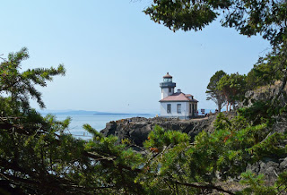
There are lots of interpretive signs by the lighthouse that make it clear that the chances of seeing a whale here are probably better than the chances of winning the lottery, but not a lot better. The last whale sighting was at 11 p.m. last night, we read on a blackboard. Then we look at a chart. Last year, orcas were only sighted here 150 times. We don't feel so bad about not seeing a whale after all. The odds were against it. But, it was a lovely place to picnic, nonetheless.


The park also features, as its name implies, the ruins of lime kilns used from the late 1800s well into the 1900s. Limestone was quarried on the island, broken into six inch diameter chunks, fed into the 1,000 degree kilns, and shoveled out the bottom as lime. To keep the fires burning took prodigious quantities of wood, and they practically denuded the whole island of trees before lime production ceased. There is little old growth forest here, but the island has recovered well.


Where conifers have not reclaimed the land, there are orchards and farms. We tasted wine at an island vineyard and winery, and stopped to admire fields in purple bloom at a lavender farm. There are fields of grazing sheep and goats, lots of horses, and even an alpaca farm (with a lone camel who probably wonders how he got here among the alpacas).


Friday Harbor, where the ferry docks, is the main town on the island, with many coffee shops and restaurants, and other lures to tourists. The bakery/espresso shop here opens at 4 a.m. to serve the early ferry, and stays open until the last ferry of the evening. We love this shop—it's where we got our coffee and pastries at 6:30 a.m. before bird watching, and where we went at night when we craved a sweet end to our day. After enjoying a pizza and a great local blues band at an Italian restaurant in town, we stopped in at the bakery for a late night fresh strawberry rhubarb cobbler.


We left the island on the 1 p.m. ferry on Saturday. Everyone told us to get there are least two hours early, because it is a popular ferry, and if it fills up, the wait for the next one is almost four hours. Once you get your car in line,
you can just leave it there, and stroll about town until boarding time.


While our car sat in the ferry queue, we enjoyed the Friday Harbor Farmer's Market that happens every Saturday. It was a wonderful opportunity to see all the products that come from the farms we passed as we drove around the island. There were fresh cut flowers, goat cheese, organic eggs, berries, herbs, honey, bread, meat and fish vendors, and baked goods, all sold on a bluff overlooking the bay and marina below.


We took a stroll around the Friday Harbor Marina before heading back to our car. We think the San Juan Islands would be a tremendous cruising ground—scenic, with many fun ports of call--akin to the Chesapeake Bay, but not as hot in the summer. Based on the huge number of beautiful boats here and at the Roche Harbor Marina on the other end of the island, there are many boaters here who would agree.


Our ferry ride back to the mainland was fog-free. We ate our lunch at a table next to a window, watching the scenery go by. There were lots of Saturday sailors, trawlers and fast boaters all around, and even a ski plane or two threading through the traffic to find a straight line for take-off.


San Juan Island has been a highlight of our journey, and we can imagine spending much longer in this area exploring the other islands in the San Juans, but we are both ready to head home now.


Eastward ho!

Saturday, July 25, 2009

Passing Though Seattle

July 21


After a regular diet of small town touring, it seems we have become intimidated by big cities. We are tempted to skip Seattle entirely, but decide we would regret it later. So we steel ourselves for the drive into the big city, brave the heavy traffic on the expressway and the confusing confluence of ramps and signs as we approach downtown, find a parking garage (where it will cost us $14 to park for less than six hours), and head to the one place every Seattle tourist visits—Pike Street Market.


It is a feast for the senses.
The merchants are hawking their wares--we taste juicy slices of white and yellow peaches from the man yelling "Peaches, peaches, peaches, we've got your peaches," and try a nectarine from another man in his stand. Further down the line of vendors, we try marion berries. We eschew the raw fish samples. We watch women who almost seem to dance with their bouquets, as they bend, twist and turn to select perfect flowers, one stem at a time, from buckets and buckets of different blooms surrounding them. The huge colorful bouquets they create sell for just $10,
no matter which one of the four flower stands along the strip you buy from.


It is all very photogenic. Neon signs above, vintage produce and fish seller booth signs, fruits and vegetables artfully arranged and frequently misted, flowers in abundance. We love this place.


We end up buying just a white nectarine and a yellow one, which are so juicy we have to bend over to eat them, letting the juice puddle on the sidewalk beneath us. Still hungry, we find a contemporary Vietnamese restaurant with a deck overlooking Puget Sound, where we have a wonderful lunch with a view of the boats below and the mountains in the distance.


Our last stop is the Seattle Art Museum, where we plan to do a quick tour (they actually have a highlight tour entitled "If You Only Have an Hour"). We can't resist the "Ten Compelling Characters" highlight tour (focusing on the subjects of ten art pieces, ranging from Elvis Presley, as seen by Andy Warhol to an Egyptian mayor portrayed on a 4,000 year old stone tablet). So we combine the two highlight tours, which already puts us over an hour. We also want to see the Andrew Wyeth special exhibit, and, of course, we run across some other interesting paintings and sculpture on the way to the highlights,
we eavesdrop on a docent-led tour for a few minutes. They have a lot of beautiful and intriguing Northwestern tribal artwork, and some contemporary art that captures our fancy. We spend a little over two action-packed hours at the museum, and could have easily spent two more.


But, we have to be on our way, because we have a schedule to meet. Tomorrow, we are taking the ferry from Anacortes to San Juan Island, where we have reservations to stay three nights at a Bed and Breakfast. We need to get to Anacortes this afternoon in time to find a motel before they are all booked up with other people heading out on morning ferries to the islands. We can't just call in advance and make a reservation, because we are hoping to stay in a "modestly priced" establishment, and the only way to be sure a cheap motel meets our high standards is to check it out in person. We have found this out the hard way.


We crawl out of Seattle in bumper-to-bumper freeway traffic that doesn't let up for over thirty miles. We are looking forward to getting back to our small town itinerary.

Thursday, July 23, 2009

Olympic National Park

July 19-20


8,000 miles


Our time in Olympic Park National Park is short, less than two full days, but we manage to explore a rainforest, hike to a waterfall in a montane forest, clamber over the rocky ocean shore, and walk a wildflower-covered mountain meadow, as we sample the diverse ecosystems of this spectacular park.


We picnic on a hill at the edge of the rainforest, overlooking a snow-fed lake.

When we hike deeper into the rainforest with a ranger, we learn that the Red Cedars and Sitka Spruce trees which tower over us are hundreds of years old, a few even took root 1,000 years ago. The fallen trees are ancient, too. It takes a long time for them to decay in this cool damp place.

We are in the forest primeval, a mystical place where elves and Paul Bunyan giants would choose to dwell, if they could pick anywhere on earth.


We reach a broad clearing in the rainforest where the Kestner family chose to claim their homestead around the turn of the last century. We can't begin to imagine how they cleared 37 acres of the rainforest, taking down trees 20 feet in diameter, and replacing them with little apple and cherry tree seedlings.


We leave the rain forest, and drive through another section of the park that runs along the Pacific Coast.

We park at the top of a bluff and walk down a zig zag trail to get to Ruby Beach, which is mostly smooth flat rocks, the kind that are great for skipping across the water. Huge logs, bleached white from their time in the sun and sea, are piled like matchsticks along the tide line. We climb over and through them to get to the water. Signs along the beach warn people to stay away from the logs at high tide, because once they start floating and getting moved about by the waves, they can be deadly. No problem today—we are here at dead low tide.


People have made thousands of little piles of flat rocks along the tops of the logs, an intriguing form of collaborative beach art. But the real rock art stands offshore, where massive rock obelisks jut high above the breaking surf. They call them stacks here. They are otherworldly and beautiful to us, treacherous to the boats that have foundered on their shorter brethren lurking just below the surfaces.

After our stroll along the beach, we head for our motel in Forks, a town that has latched onto "Twilight" the way Roswell latched onto aliens. The entrance to the town sports a sign that says "Welcome to the Twilight Zone," and numerous hotels, including ours, advertise "Twilight Rooms." Many shops in town refer to Twilight, and we realize that a significant pop cultural trend has passed us by, once again. Some quick Googling reveals that "Twilight" is the first book of a series of four wildly popular teen vampire romance novels set in Forks, Washington. The book has been translated into 20 languages, and was made into a movie in 2008. Forget about elves and Paul Bunyan, we'll keep our eyes open for vampires around here from now on.

The next morning we head north and east, continuing our drive around the perimeter of Olympia National Park. Unlike the other national parks we have visited, Olympia does not have roads running through it, but rather has roads that penetrate a relatively short way into the park from many perimeter locations, keeping the core of the park wild and undisturbed, accessible only to backpackers with permits.

Mostly, the perimeter road is a two lane ribbon cutting through tall pine forests that come almost right to the shoulder of the road. But, there a patches of the forest that have been recently harvested, and it is clear that the state is trying to help us not feel so bad about the eyesore, and the loss of trees. Here is their Burma Shave style series of signs:


WE CUT SOME TREES

TO HELP THE COUNTRY.

WE PLANT SOME MORE

FOR FUTURE BOUNTY.

STATE TRUST LANDS/MANAGED WITH CARE/REPLANTED 1991.

We feel worse about a hillside covered with stumps of trees than we do about a farm field covered with the stubble of a harvested crop, and this bad poetry is not helping.

Now that we are further from the Pacific Ocean, we are no longer in rainforest, but the hemlocks and firs are fragrant and the path is soft with a thick layer of pine needles as we hike to Marymere Falls.
We cross a creek by walking across a bridge made of a single old growth tree log, sliced in half.


We meet a man panting up the hill to the falls with his toy poodle in a kangaroo pack baby carrier. He admits he has the world's most pampered poodle.


When we finally reach Marymere Falls, it is strikingly tall, a long white plume against a stark black rock cliff, surrounded by the soft green mosses and ferns reaching out to take a drink. It reminds us of the falls we saw along the Columbia Gorge, except that here we don't have to jockey with a hundred other people to get the angle we want or get a shot without people in it. It is more peaceful here.

We drive 5,700 feet up the side of a mountain to Hurricane Ridge, where the winter winds can reach 100 miles per hour. Today, we just have a pleasant breeze while we eat our picnic at a table with a view of subalpine meadows and mountains stretching to infinity.


A team of Gray Jays approaches our table and works together to steal our Pringles. One of them diverts Dick's attention by hopping on the table, creating an irresistible photo opportunity. When Dick puts his camera to his eye and starts adjusting it, another one hops on his plate and nabs a chip. When we turn out attention to shooing him away, another swoops in to make a try at my plate. It is very difficult not to feed the wildlife when they insist on helping themselves so boldly.


We hike through a subalpine meadow with a ranger,
and take lots of pictures of the wildflowers in glorious bloom.


Then we are on our way south to Kingston, where we catch a ferry to Edmond, just north of Seattle, where we decide to stop for the night, because it has been a very full day, and we can't bear the thought of fighting traffic and trying to find a hotel in a big city on top of everything else we have done today. Edmond has no other features to recommend it beyond these—it is where the ferry docks at the end of a long day, and it has plenty of reasonably priced hotels.

Wednesday, July 22, 2009

From Sea to Shining Sea

July 19
After traveling 46 days and 8,000 miles, we have reached the Pacific Ocean. Here is our commemoration of this moment in our journey:

Oh beautiful for spacious skies,

For amber waves of grain,
For purple mountains' majesty
Above the fruited plain. America,

America,

God shed his grace on thee,

And crown thy good

With brotherhood

From sea

to shining sea.


Tuesday, July 21, 2009

Our Lucky Day in Greater Portland

July 18


We are staying in Gresham, a vibrant little historic community just east of Portland. When we had dinner downtown last night, we noticed at least fifty poles along the street covered with colorful shoes, and there were posters in all the store windows advertising Gresham's Annual Art Walk. The Art Walk happens just one day a year, and it just happens to be the day we are here, so it must be our lucky day!


When we return this morning, all of downtown has been blocked to traffic and turned into a pedestrian mall. Blocks and blocks of art vendor tents line the streets, and there are musicians spread throughout the town, adding their notes to the festive atmosphere. We recognize some of the scenes portrayed in the photos and paintings—waterfalls we visited along the Columbia Gorge, views of Mount Hood and Vista House. Oh, if only we had been there when the light was so perfect or the sunset so dramatic, we think.


After we fully savor the art, we head to the Fabric Depot, a huge fabric store with over 11,000 bolts of quality cotton quilting fabric, according to a flyer Dick picked up at the Welcome Center. When we get there, I know this must be our lucky day, because the store is having a sale, and all of their fabric is 35% off, this weekend only. The place is huge, it is overwhelming, and it is packed with wonderful treasures. I wander around in awe and wonder for a while, then start filling up my shopping cart with bolts of fabric I can't resist. Dick tells me we were there a couple hours. I lost track of time.


Our next stop is a place in downtown Portland where we can both lose track of time—Powell's Books. It is the largest new and used book store in the world, taking up a full city block (a big one), with four floors packed full of attractively priced books of all sorts. We browse and read for a couple hours, and buy just a little pile of books, since our car is pretty tightly packed already.


Then it is time for dinner, and taking the advice of our road trip book, we dine at Jake's Famous Crawfish, a downtown Portland landmark for over 110 years. I order salmon roasted on a cedar plank, a dish I remember fondly from my last visit to the Pacific Northwest over 20 years ago. I have been eagerly awaiting the moment when we would arrive at a restaurant offering planked salmon, and here we are, on our lucky day. When our server stops by to be sure all is well with our food, I tell her it is even better than I remember it from long ago. She tells me that kitchen stores around town sell cedar planks, if I want to make it at home, and I insist that I could never replicate the sauce, which is part of what makes the salmon here so special.


Five minutes later, she returns to the table with a somewhat charred well-seasoned cedar plank wrapped up in a bag, and a recipe for the sauce hand-written on a sheet torn from a notepad. If this is the kind of service and food they offer here, no wonder Jake's has been around for over 110 years.


We have had so much good luck on this trip—little rain, good health, accommodations in National Parks obtained at the very last minute, no flat tires or other car troubles . . . the list of things for which are thankful is long every night.


But, we agree that today stands out as an extra lucky day.

Monday, July 20, 2009

Another Day, Another Scenic Byway


July 17

Yesterday we followed the river on the Columbia River Highway, today we are circling the mountain on the Mount Hood Scenic Byway, a 105 mile crescent-shaped route that begins where the Hood River meets the Columbia, just west of The Dalles, and ends just east of Portland. The snowy peak of Mount Hood, at 11, 245 feet, is visible from almost every stop we make along the highway. Consequently, we have well over 100 Mount Hood shots by the end of the day.


The first leg of our journey takes us through the Fruit Loop, a fertile swath of the Hood River Valley that runs for about 30 miles, brimming with orchards, vinyards, berry patches, farms and farm stands. Not realizing the bounty that awaits us, we stop at the first stand we see to replenish our supply of local cherries. There we pick up a map of the local farm stands—there are 34!


We manage to limit ourselves to just two other Fruit Loop stops. At Hood River Lavender Farm, we loll amid the fields of over 70 different varieties of organic lavender, and other mixed flower gardens. The fragrant gardens are in the peak of their bloom, and humming with bees. There are lots of chairs scattered about the grounds for lounging, a little garden shed is full of lavender products (including a pear jelly flavored with lavender with little spoons for sampling), and photo ops abound, including many shots of gardens in the foreground and Mount Hood in the background.


We finally tear ourselves away, and drive down the road to the Draper Girls Country Farm, where we end up stopping right after two truckloads of forest service fire fighters unload. They are wearing tee shirts that identify them as the Zig Zag Hot Shots (Zig Zag is a town we will pass through along our scenic route later this afternoon). While chatting with a fire fighter woman in line ahead of me, I learn they are on their way home from a couple "man-made fires" in Washington. It hasn't been much of a fire season so far, but they keep busy doing other forest service work that uses their skills, such as clearing hazardous downed trees along forest service trails or doing controlled burns. They also spend a lot of time training. They all look incredibly fit, and terribly young.


We add frozen apple and pear cider pints to our cooler, and dried cinnamon apples to our snack bin, and, after a brief picnic stop in Mount Hood National Forest, we are on our way to Timberline Lodge, the only four season ski resort in the lower 48 states. It is also our country's first government-owned lodge/resort, built as a WPA project, and dedicated by Franklin D. Roosevelt in 1937. We get there just in time for the 2 p.m. ranger tour of the lodge, where we learn more about the impressive craftsmanship that went into the making of this building. It had to be built strong to withstand 22 feet of snow piling up on it and drifting around it in winter. The design is ingenous, because it is strong, yet it has soaring spaces and lots of glass to provide great views of the mountain.
But, the indoor views are spectacular, too.
Everywhere we look, there are hand-crafted details—carved wood trim, decorative wrought iron, hand-hooked rugs, and fine stone work. A series of linoleum cut murals lines a large recreation room. Women got together to make curtains and quilts for the lodge guest rooms, which were all decorated differently in the lodge's earlier days.


When we are done wandering around the ski lodge, we go outside to watch the skiers. The lifts have just stopped, and everyone is on their last run of the day, but it is a big mountain, so it will be quite some time before the slopes are empty. When we get to the parking lot, there are 20 busses from just one ski tour provider lined up in the lot to take clients down the mountain and back to town.


We are ready for a little exercise ourselves, and the ranger recommends a path around Trillium Lake, which lies in the national forest not too far from the foot of the mountain. When we get to the parking area, we see two ambulances and several police cars across the lake. With my binoculars, I can see that a medic is performing chest compressions on an adult. There are a lot of people in bathing suits standing in shallow water or on shore, watching the action across the lake.


Sobered, we walk the trail. Since it circumnavigates the lake, we frequently have a clear view across the water, where we can see the CPR continuing. We hear from some fishermen that the ambulances have been here over an hour. We do not hold out much hope. But, later, when we are deep in a wetland beyond the lake, we hear sirens departing, and decide that must be a good sign. We pass a little ampitheater on a point overlooking a quiet inlet filled with lily pads. It is roped off and reserved for a wedding. Later, as we are almost to the spot where the ambulances were parked, we can hear a big group singing "Happy Birthday," their voices carrying across the lake. We feel as if we have witnessed the full circle of life in our little walk around the lake.